MAP TAB
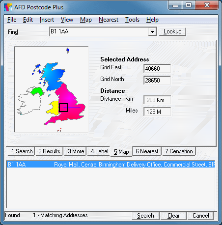
The Map Tab (keyboard shortcut [Alt]+4) is used to display the approximate location of an address record on a 1:200,000 scale map for British, Channel Isles and Isle of Man addresses and a 1:500,000 scale map for Northern Irish addresses.
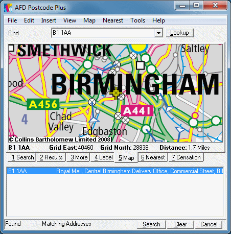
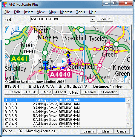
A postcode can be displayed on the on-screen map by clicking on the entry in the Results List underneath the Map Tab. The map will move with the location of that address at it's centre.
Options are available from the 'Map' menu which is also accessible by right clicking on the map image.
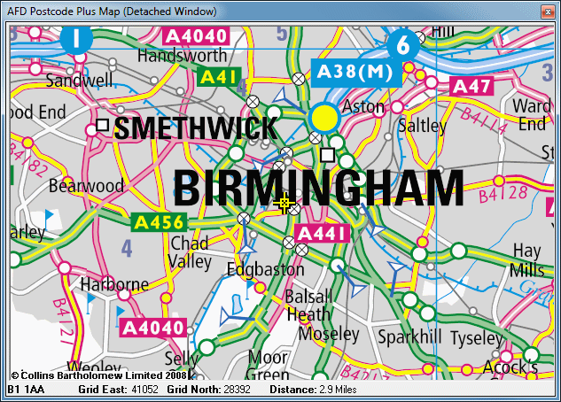
Selecting 'Detach' from the 'Map' menu will open the Map in a separate resizable window, allowing a larger area of the map to be displayed at any one time (the UK outline map will be displayed on the Map tab). Selecting 'Detach' again will reattach it to the main window. All the functions available for the map on the main form also apply to the map when displayed in a detached window.
Simply holding down the left mouse button over the map image while dragging the mouse around, allows you to move around the map, the address selected will continue to be marked on the map itself, while it is visible. (Providing 'Move or Crop' is selected from the Map menu). You can only move around the map when you are viewing it full size (1:1).
Nearest locations from your Nearest database (see the Nearest tab) are displayed on the map as blue square boxes with a cross head through them. Moving your mouse over one of those locations will display a tool tip next to it showing it's name. If you prefer not to see these locations displayed then deselect the 'Display Nearest Locations' option from the Map menu. Nearest distances are the linear distance between the two points so viewing the Nearest locations on the Map can help spot if the second nearest location might actually be quicker to get to when driving.
By default the Distance displayed underneath the map image on the Map tab is the distance from the point over which the mouse is placed to the selected address. To find the distance from any points visible on the map, or to draw out a series of lines to find a non-straight line distance to a location (e.g. following roads etc.) select the 'Distance Measuring Line' from the Map menu.
With this simply click the point at which you want the line to start and then click each subsequent point to measure out the distance. The accumulating distance is displayed below the Map image.
To finish drawing a line un-check the 'Distance Measuring Line' option from the Map menu or use the shortcut [Ctrl]+M. (Selecting it again will start a new line). Double-click on the Map to clear the line.
To return to the original mode in which you can move around the map, simply re-select 'Move or Crop' from the Map menu.
If you wish to view more detail on the map at one time, at the expense of seeing the detail you can select different view levels from the 'Map' menu. Zoom Levels 1:1 through to 1:5 are available. When the Map is not at it's full size (1:1), the move function is not available due to the additional processing overheads needed to process the larger quantity of data.
Transferring Map Images To Other Applications
Three methods are supplied for getting the Map images into other applications:
OLE Drag & Drop
Simply hold down shift and the left mouse button and drag the map to any OLE Drag & Drop (bitmap image) supporting application such as Microsoft Word, Paint Shop Pro etc. The image is transferred as is displayed, so if you want the map zoomed out/in you can do this before transferring it and you can determine it's size by detaching the window and resizing it as desired.Windows Clipboard
Select 'Copy Map Image' from the 'Map' menu to copy the currently displayed Map image to the clipboard ready to paste into any other Windows clipboard supporting (bitmap format). As with OLE Drag & Drop the image is transferred as it is displayed.Developers Access
Programmers can get the data for Map images for a specified Grid Reference directly into their applications by using the AFD Utility DLL. See the API documentation for more details.Please Note: You are licensed to use maps for each license of an AFD product you have on the desktop. You may not transfer map images to any third party or use them on the Internet. To gain licenses / access to data for other uses please contact Bartholomew directly on 01242 258 134 and mention AFD.
You can print maps to any printer setup in Windows using AFD Postcode Plus. Maps are printed in a standard format consisting of the address selected, a local map and a larger zoomed out map of the surrounding area. They are printed formatted for printing on A4 size paper in Portrait using the label settings from the Label tab. For more advanced printing use the methods above to transfer the image to another application for printing.
Getting An Overview Of A Place's Position In The British Isles
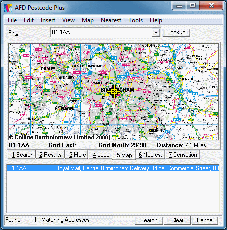
If you wish to see the location of a place on a miniature map of the British Isles, simply turn the detailed map off (Uncheck 'Detailed Map' from the 'Map' menu).
You can measure approximate distances using this map by using the distance line tool on this map.
No Grid References are available for postcodes in the Isle of Man (IM), Jersey (JE), or Guernsey (GY). Some other postcodes, such as PO Boxes, also do not have grid references available for them.
To allow these addresses to be shown on the Map, where no grid reference is available, Postcode Plus will use the grid reference for the centre of the locality or town that the address is in to allow it's approximate position to be shown on the Map. These approximate values can also be used from Insert if selected from the Grid Reference options in Properties from the File menu. They are also accessible through the Utility DLL for developers.
See also the Appendix on Grid References.